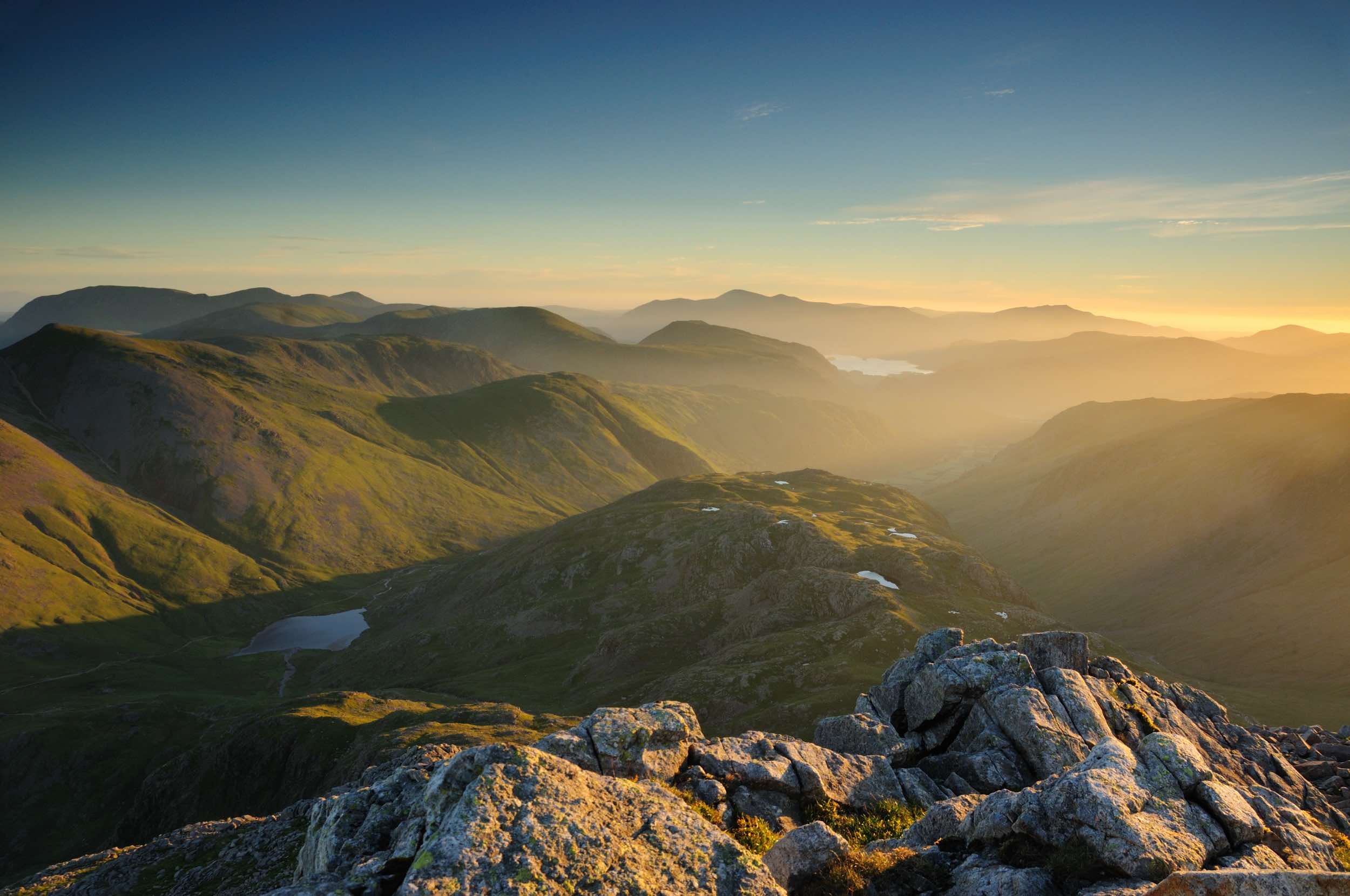
Breathtaking Landscape of the Cumbrian Fells
The fells of Cumbria are the highest, craggiest and most dramatic in England. This is a breathtaking landscape of often rocky summits towering over deep, dark lakes and tarns. A landscape lauded by poets and celebrated by artists for centuries, a landscape worthy of its World Heritage status. This is what people come to see, the reason why tourists have been flocking to the Lake District, Cumbria for generations.
Origins of the Term “Fells”
The term “fells” used to describe Cumbria’s mountains has its roots in the old Norse word “fjall” or “fjell,” meaning mountain. Norse settlers in the Cumbrian uplands in the ninth century left their mark on the local language, contributing words like “ghyll,” “tarn,” and “force,” which have Scandinavian origins.
Notable Fells in the Lake District
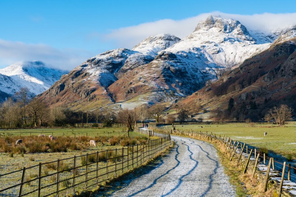
The Lake District’s highest fell – indeed the highest in England – is Scafell Pike. Its boulder-choked summit sits at 3209ft, or 978m, above sea level and is located towards the western edge of the National Park. Its neighbour, Scafell (3162ft/964m) is England’s second highest mountain. The third and fourth highest are Helvellyn (3116ft/950m), towards the east, and Skiddaw (3054ft/931m), in the Northern Fells, respectively.
Glacial Shaping of the Landscape
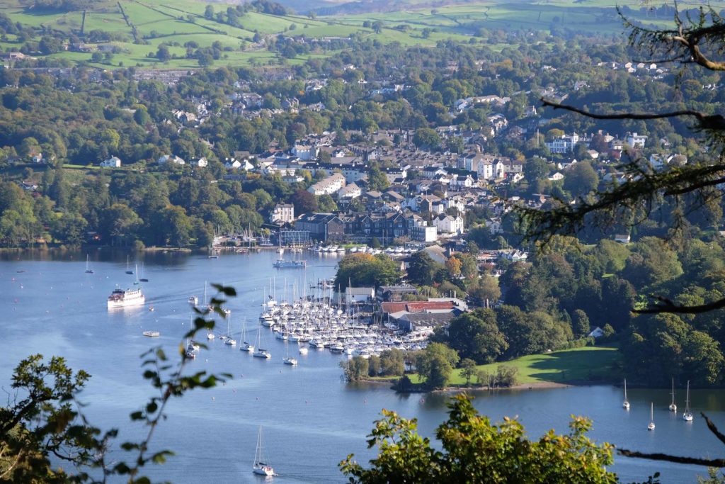
The underlying geology is largely volcanic with significant areas of slate as well. The landscape here has been carved and shaped by the processes of glaciation. The huge ice sheets that covered this area, many millennia ago, created most of the features that are now regarded as typical of the Lake District. Narrow ridges known as arêtes, corrie tarns and hanging valleys. Even the famous valley-bottom ribbon lakes themselves, Windermere included.
Outdoor Activities in the Fells
The Lake District fells are extremely popular with outdoor enthusiasts, including walkers, climbers, scramblers, mountain bikers, swimmers and paragliders. In winter, when conditions allow, mountaineers and ice-climbers descend on the region armed with crampons and ice axes. Although the summits are low by international standards, these fells throw up some serious challenges. In terms of terrain and weather conditions, they need to be treated with respect. It’s important that those taking to the fells are properly equipped for the activity they’re undertaking and know how to use that equipment.
Beyond the Lake District: Cumbria’s Other Mountainous Areas
Beyond the Lake District, Cumbria’s Fells fall largely into one of two other protected areas. The Yorkshire Dales National Park and the North Pennines Area of Outstanding Natural Beauty. The Yorkshire Dales takes in the Howgill Fells, a compact group of grassy, rounded hills above the town of Sedbergh. Also the lonely moorland tops above Mallerstang, part of the Upper Eden Valley. In the North Pennines, there are huge expanses of heather moorland. Cross Fell – at 2929ft, or 893m, the highest point in England outside of the Lake District.
Like the Lake District, outdoor pursuits are a big draw in the Dales and the North Pennines, with walking the most popular activity. Hikers on the 268-mile Pennine Way usually spend a couple of days in this part of the county, crossing the highest and wildest ground they’ll encounter on England’s oldest National Trail.