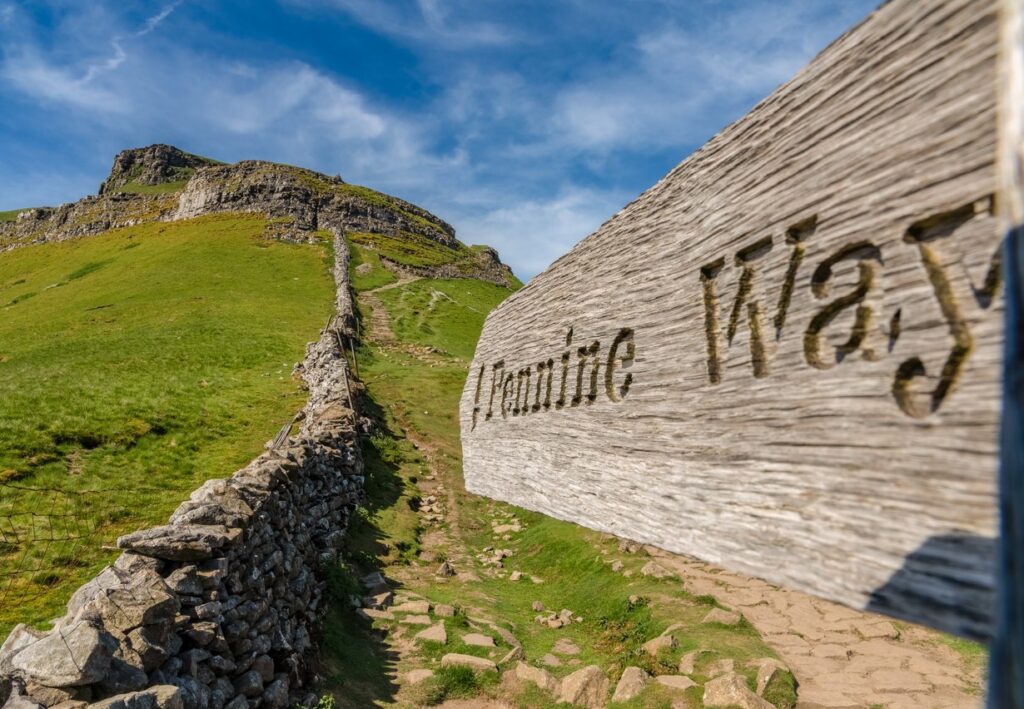
Discovering the Pennine Way
The Pennine Way was England’s first National Trail – established in 1965 after having been suggested by access campaigner Tom Stephenson 20 years earlier. The long-distance walking route follows the ‘spine’ of northern England. From Edale in Derbyshire to Kirk Yetholm, just over the Scottish border, a total of 268 miles. It passes through some of the remotest hill country in England. This includes the Peak District, the Yorkshire Dales, the North Pennines and the Cheviot Hills.
Highlights of the Pennine Way
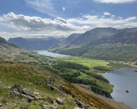
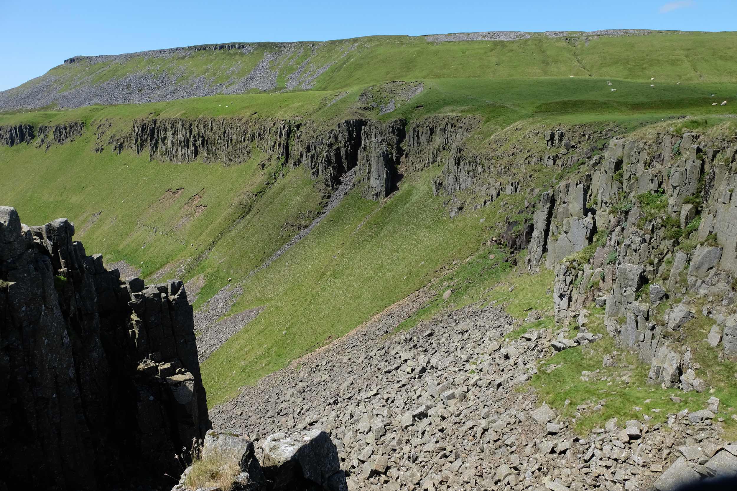
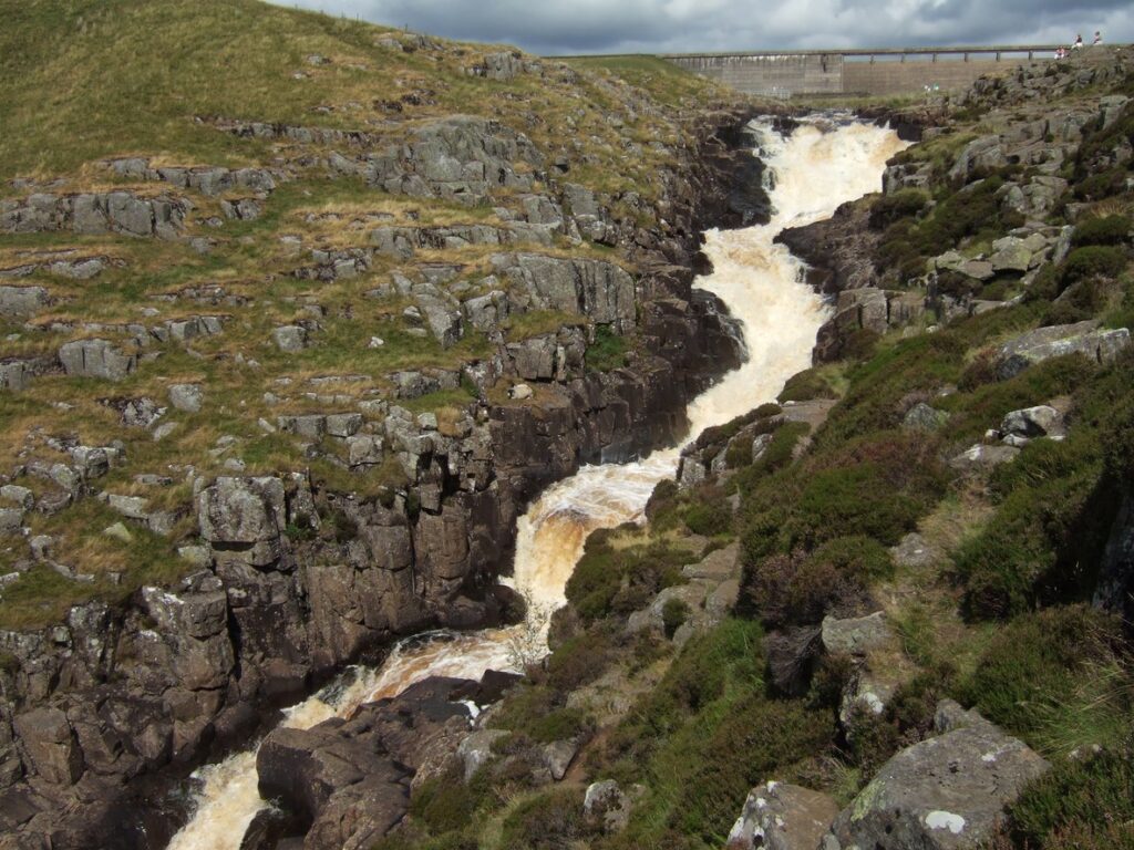
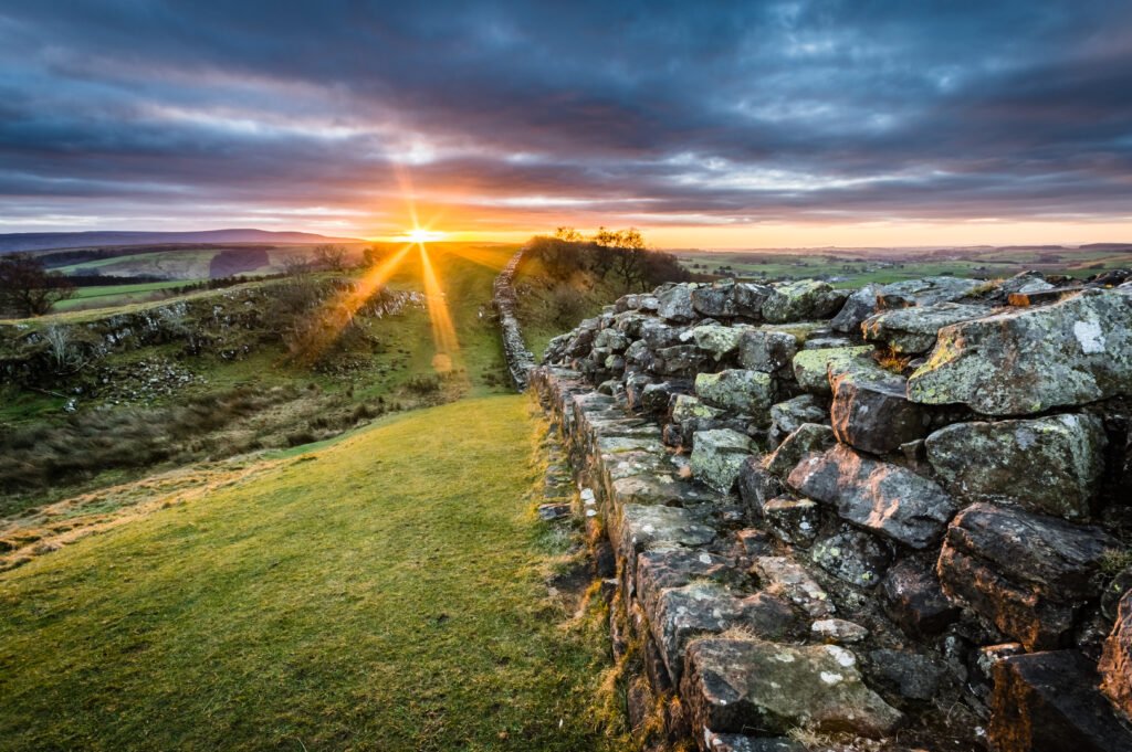
Walking the Pennine Way south to north, as most people do, hikers enter Cumbria near Cauldron Snout, a waterfall in Upper Teesdale. Crossing high, bleak moorland, they then come to High Cup, one of the most impressive geological features in the Pennines. From here, the route drops to Dufton in the Eden Valley. It then climbs back up the western escarpment to Great Dun Fell and Cross Fell, the highest point on the entire trail. After calling in at Garrigill and Alston, walkers follow the River South Tyne north. Then enter Northumberland to join the Hadrian’s Wall Path National Trail.
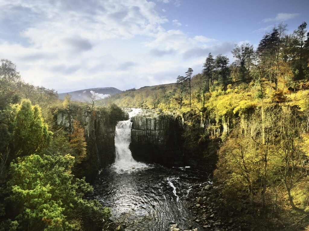
This is the journey of a lifetime along the Pennine Way, with breathtaking beauty and experiencing the diversity of northern England. From the historic charm of the Tan Hill Inn, the exhilarating hikes up Pen-y-Ghent and Great Shunner Fell, the geological wonder of High Cup Nick, to the mesmerizing sight of High Force waterfall – each destination offers a unique and unforgettable experience. Explore the cultural charm of Hebden Bridge and the picturesque village of Horton in Ribblesdale to name but a few highlights along the Pennine Way.
Fastest Completion Time on the Pennine Way
Mike Hartley holds the record for completing the route in the fastest time. Two days, 17 hours, 20 minutes and 15 seconds. He ran it in July 1989, forgoing sleep and stopping only twice – for 18 minutes each time. Lesser mortals aim to complete it in roughly 16 to 19 days. Stopping overnight in B&Bs, hostels, pubs and campsites along the way.
Access to the Pennine Way
The Pennine Way is accessible only to those on foot. For horse-riders and cyclists, the 205-mile Pennine Bridleway was established in 2012. Following a completely different route to the Pennine Way, this runs from Derbyshire to Cumbria, where it ends near the village of Ravenstonedale in the Yorkshire Dales National Park.
Places to stay along the Pennine Way
The Rambler Inn & Holiday Cottage – Edale
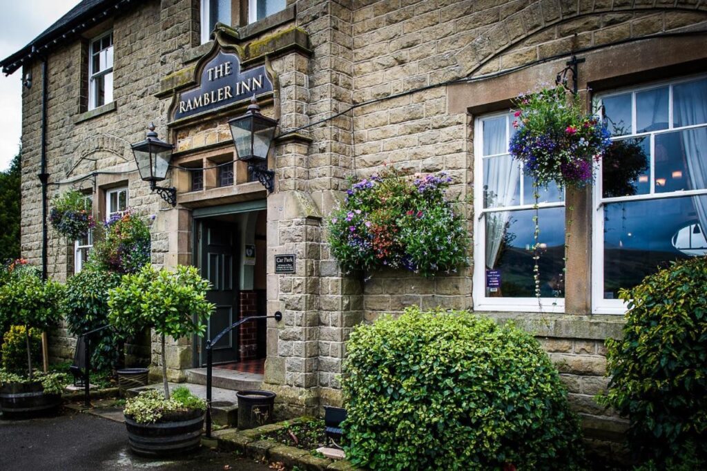
The Rambler Inn & Holiday Cottage the perfect starting point for your Pennine Way adventure. The comfortable en-suite rooms offer modern amenities, free toiletries, and stunning mountain views. Indulge in diverse dining options and a wide selection of drinks at the open bar or beer garden. Positioned at the start of the Pennine Way National Trail, just a 4-minute walk from Edale Station. A tranquil river awaits you within a 6-minute stroll. A sanctuary in the Derbyshire Peak District, where you can rest, recharge, and embark on your journey on the Pennine Way.
Address: Hope Valley, Edale, S33 7ZA,
>> Check rates and availability
Town View Alston
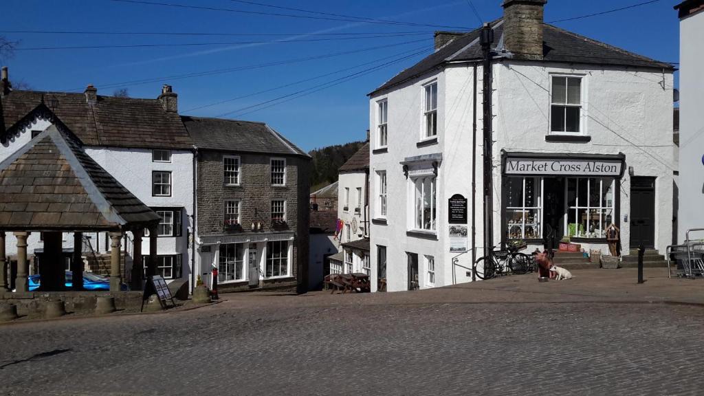
Looking for a luxurious haven to rest your weary legs on your Pennine Way journey? Look no further than Town View Alston, a self-contained studio apartment perched above a charming gift shop. You’ll be welcomed by cobblestone streets and breathtaking views of the historic Market Cross, providing the perfect respite for the intrepid traveller.
Inside, you’ll find a fully equipped kitchen, plush oak furnishings, and a log-burning stove to keep you warm and cosy. Enjoy some entertainment on the 42-inch flat-screen TV, or relax in the comfort of your luxurious surroundings. With fresh towels, cosy bed linen, and thoughtful amenities, you will surely have a restful night’s sleep. And to start your day off right, we’ve included milk, tea, coffee, and cereal, so you can enjoy a hearty breakfast before continuing your journey.
Address: Market Cross, Market Place, Alston, Cumbria. CA9 3HS
>> Check rates and availability
Mill House – Kirk Yetholm
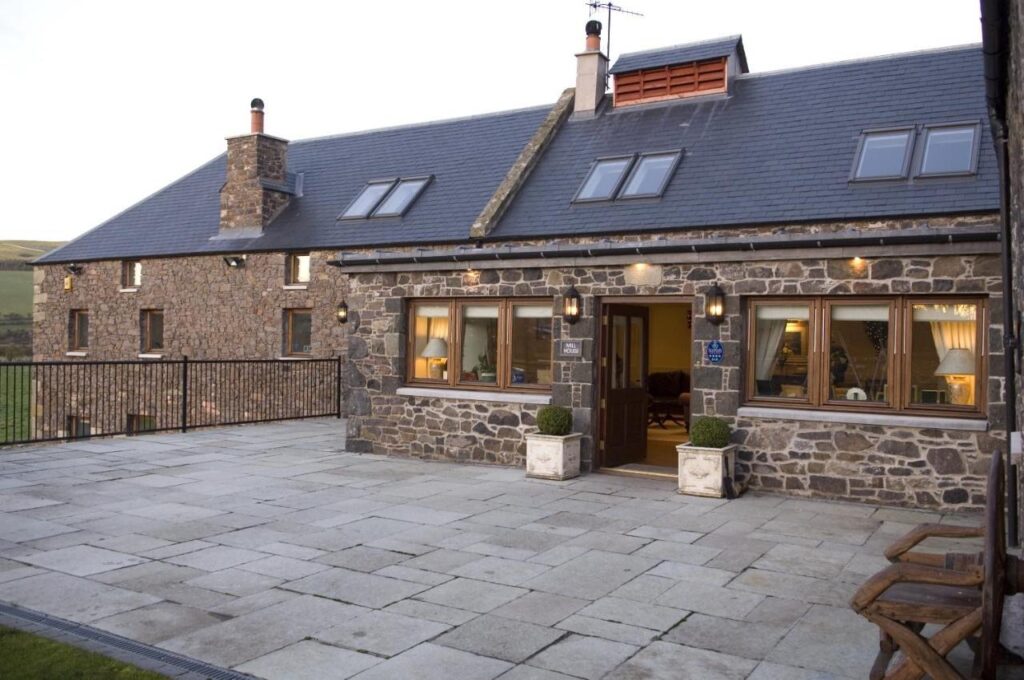
The tired traveller who has completed the legendary Pennine Way can find a serene retreat in the charming village of Kirk Yetholm. The tastefully appointed 18th-century converted Grain Mill offers picturesque views of the Cheviot Hills and a perfect setting for a well-deserved long weekend of relaxation and celebration. Adventure seekers can explore the nearby hills through hill walking or cycling, while fishing and golfing are also available. The property covers all requirements, making it an ideal sanctuary of rest and reflection for weary travellers. It’s the perfect place to cherish the memories of your Pennine Way triumph and embrace the peace and beauty surrounding you.
Address: Kirk Yetholm, TD5 8PE